Wairoa Stream Projects: 7 years in and still plenty to do
- By Cliff Mail
- May 2, 2019
- 2 min read
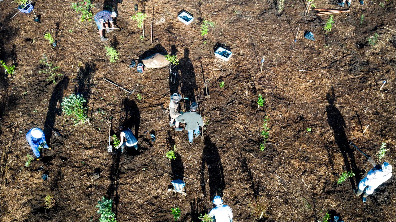
Last Monday the Friends of the Wairoa Stream carried out the first plantings of the short 2019 planting-window that runs from late autumn through to mid winter. The team managed to plant around 250 young native trees and shrubs on the difficult terrain above the Te Wairere waterfall.

This was just the latest instalment of the ongoing community effort that is now in its 7th year. The Wairoa Stream Project has multiple aims of; creating public access to the stream banks via a walkway, weed eradication and, linking remnant patches of bush with native plantings to form a continuous lowlands forest and wildlife corridor through Kerikeri.
Around 5,700 hours of volunteer labour has gone into, amongst other activities; planting around 11,000 native plants, constructing just over 3km of track and the building, of two significant foot bridges and a number smaller bridges and boardwalks. Despite all of this effort, the project is still very much work in progress.
Some of you will have had the opportunity to walk the track but for those who have not or who are unable to, we have recently started to compile an interactive map of the project. It uses Google My-Maps that we have been able to overlay details and the status of our planting areas. We have included pictures for each of these areas that shows the progress of some of the areas from their original weed infested state to how they appear today.
Like the project, this map is work in progress. We will endeavour to keep it up-to-date with new images as well as marking our progress as we continue with the project.
View the map in full-screen (recommended) by clicking the [ ] symbol on the right hand side of the map title bar. Alternatively, click the symbol on the left hand side of the title bar to display the different areas of the project - clicking on any named area will display the notes, the location and photos associated with that area.


Comments